
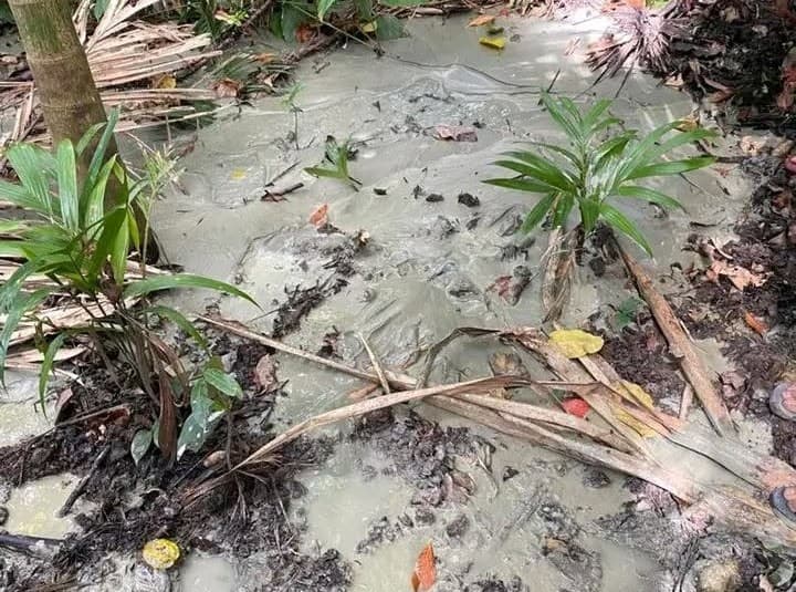
VIQUEQUE: Recent reports of land instability in the Viqueque Municipality have caused concern among local communities, particularly where ground features exhibit "volcanic" characteristics, such as bubbling mud, viscous flows, and gas emissions. While these phenomena are visually striking and often resemble small-scale volcanic activity, geological experts emphasize that they are distinct from magmatic volcanism.
Geomorphological Context: The "Mud Volcano" Phenomenon Geologists categorize these sites as mud volcanoes or shale diapirs. Unlike traditional volcanoes, which are fueled by molten magma rising from the Earth's mantle, these features are driven by subsurface tectonic pressure and the unique composition of Timor-Leste's geology.
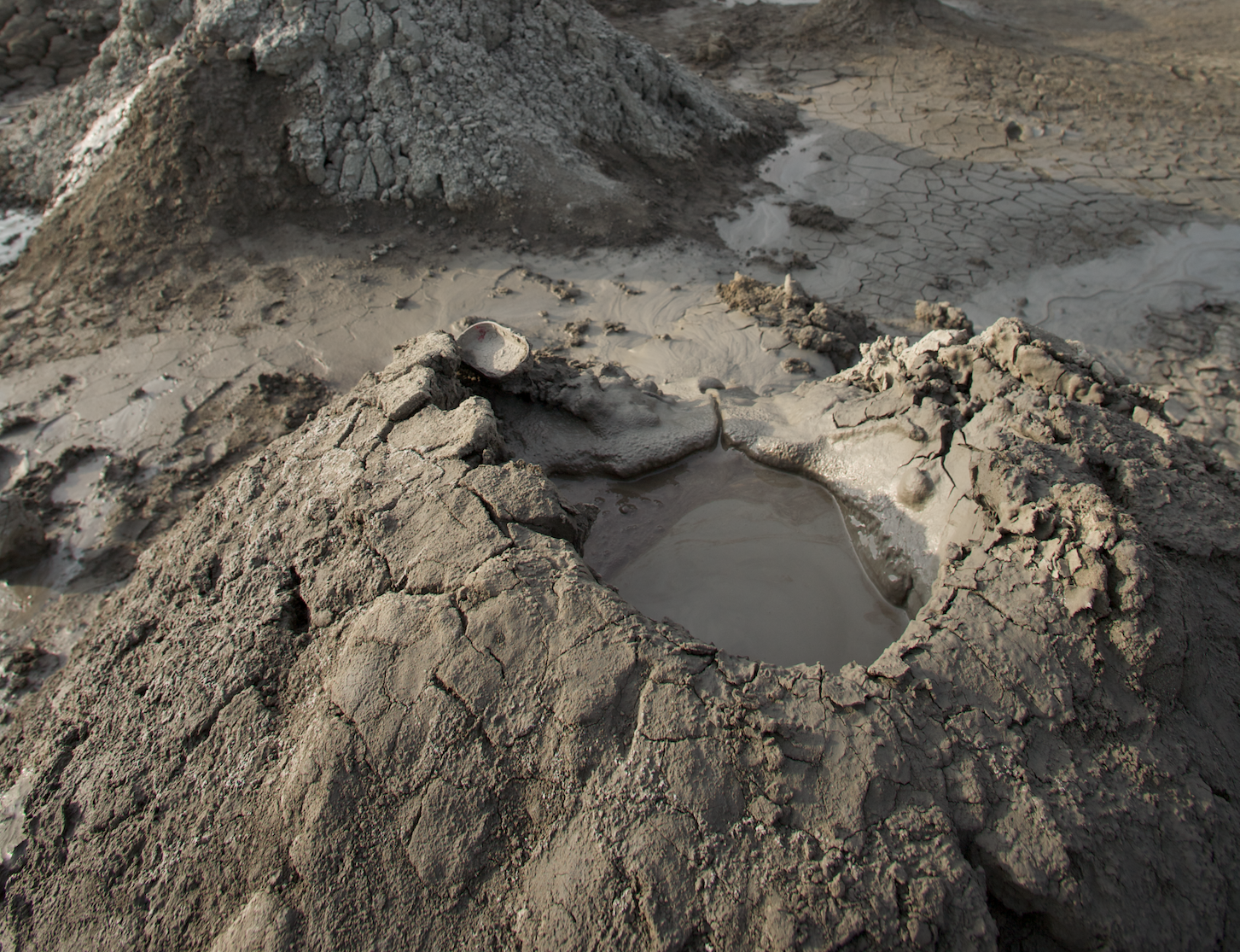
The primary driver in this region is the Bobonaro Complex, a geological mélange consisting of highly plastic, clay-rich material. When this material, combined with fluids and trapped gases like methane—is subjected to intense pressure from tectonic plate movements, it is forced upward through overlying rock layers. This process, known as diapirism, creates the bubbling craters and mud flows observed at the surface. These manifestations are not eruptions of lava, but rather the slow extrusion of pressurized, fluid-saturated clay. Linking Diapirism to Landslides. The same geological conditions that produce these "mud volcanoes" also render the Viqueque landscape highly susceptible to landslides. The region is characterized by the Viqueque Formation and the Bobonaro Complex, both of which contain clay minerals, such as smectite and illite, that possess high plasticity.
When these clay-rich soils are saturated by the heavy monsoon rains characteristic of Viqueque’s southern coast, they lose their structural integrity and strength. Under these conditions:Pore-Water Pressure Increases: Rainfall infiltrates the soil, creating internal pressure that reduces friction between soil particles.Lubrication Effect: The clay acts as a lubricant, allowing large masses of soil and rock to slide along deeper, more stable bedrock.Slope Failure: On steep terrain, these saturated clay-rich layers frequently trigger deep-seated rotational landslides, which can damage infrastructure, agricultural land, and housing.
Why This Distinction Matters.
It is crucial for public awareness to differentiate between these hazards.Not Magmatic: These events are not indicative of an imminent volcanic eruption. They are a permanent feature of the region's complex, tectonically active landscape.
Predictable Risk: The risk in Viqueque is primarily associated with rainfall-induced mass movement. Scientific studies suggest that these diapiric features often appear in areas already prone to seismic activity and slope instability."The geological architecture of Viqueque, with its chaotic, clay-rich mélange, makes the area naturally prone to both diapirism and mass wasting," noted an analysis of the region’s structural geology. "The presence of bubbling mud is a geological indicator of high subsurface fluid pressure, which serves as a warning sign for soil instability in the surrounding slopes.
"Moving Forward Authorities and local planners are encouraged to view these zones as high-risk areas for development. Engineering projects in Viqueque,such as road construction or housing developments, require careful geotechnical assessment of soil composition, drainage capacity, and slope stabilization techniques to mitigate the constant threat of seasonal land movement.
Disclaimer:
This report is based on established geological studies of the Viqueque and Bobonaro formations. Residents in affected areas should continue to follow official guidance from local disaster management authorities regarding slope safety and landslide precautions during heavy rainfall.